
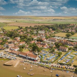
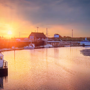
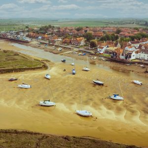
Burnham Overy Staithe Harbour
£9.99
Description
Burnham Overy is a civil parish on the north coast of Norfolk, England. In modern times a distinction is often made between the two settlements of Burnham Overy Town, the original village adjacent to the medieval parish church and now reduced to a handful of houses, and Burnham Overy Staithe, a rather larger hamlet about 1-mile (1.6 km) away and next to the creek-side harbour.
Burnham Overy Staithe Harbour lies between the larger village of Burnham Market, less than 1-mile (1.6 km) to the west, and Holkham, some 3 miles (4.8 km) to the east. The larger town of King’s Lynn is 20 miles (32 km) to the south-west (with the closest railway station), whilst the city of Norwich is 30 miles (48 km) to the south-east.
Burnham Thorpe, the birthplace of Horatio, Admiral Lord Nelson, lies 1-mile (1.6 km) to the south-east. According to various letters and documents, Nelson learned to row and sail a dinghy at Burnham Overy Staithe, at the age of 10, two years before joining the Navy. The village’s only pub is called “The Hero” in his honour.
The civil parish has an area of 8.92 km2 and in the 2001 census had a population of 311 in 167 households, reducing to a population of 134 measured at the 2011 Census.[1] For the purposes of local government, the parish falls within the district of King’s Lynn and West Norfolk.
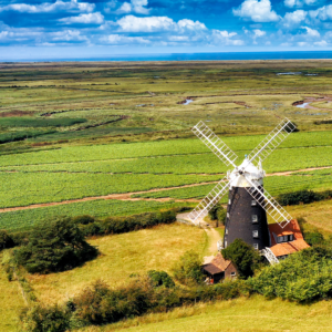
Historically Burnham Overy was the port for the surrounding villages of the Burnhams. Both settlements lie on the River Burn, and until the end of the Middle Ages trading ships were able to reach the village (now Burnham Overy Town). With the silting of the river, commercial traffic switched to the downstream Staithe. With the coming of the railway to the Burnhams in 1866, commercial shipping declined and the last cargo is believed to have been shipped from the Staithe soon after the end of the First World War.
Between Burnham Overy Staithe and the sea, the river spreads out into multiple tidal creeks through the salt marshes that fringe this stretch of coast, and finally reaches the sea by passing through the fronting sand dunes at a gap near Gun Hill locally known as Burnham Harbour. Small boats can reach Burnham Overy Staithe through this gap and creek. Today Burnham Overy Staithe, and the associated harbour, is a recreational sailing centre. It is also the point of departure for seasonal ferries to the Scolt Head Island National Nature Reserve.
To the east of the Burnham Overy creek, the former salt marshes between dry land and the sand dunes have been reclaimed to form fresh water meadows, part of the Holkham estate. A one-and-a-half-mile (2.4 km) long footpath links Burnham Overy Staithe to the sand-dunes and beach, running along the crest of the embankment which protects these water meadows from the creek.
Reviews
There are no reviews yet.